40% Faster Power-Line Inspections With UgCS Enterprise
Introduction
When our drone team set out to photograph and map hundreds of kilometres of high-voltage transmission lines in Missouri and Illinois, we ran into the same road-block every utility inspector knows: long, twisting corridors that rise and fall through forests and hills. Flying close enough to spot damaged hardware meant staying low and level—yet one wrong waypoint could send an aircraft either into a tower or too high for crisp imagery.
The Challenge
Long, twisting power lines cross forests and rolling hills.
- Crews must keep drones low and level to spot defects yet stay clear of towers and trees.
- Manual waypoint entry in basic apps was slow, error-prone, and often led to image gaps or the need to repeat flights.
Trident’s UAS team supports utility infrastructure inspections by flying long stretches of high-voltage transmission lines across rural, hilly terrain. Before UgCS, planning flights was manual, time-consuming, and error-prone, especially for corridor missions.
We needed a solution that could:
- Automate flight path creation across uneven terrain
- Reduce on-site prep and mission adjustments
- Improve data quality and consistency
- Comply with VLOS regulations in complex environments
Solution
Trident adopted UgCS Enterprise for all mission planning across their drone platforms. It quickly became a core part of our workflow—used to preplan, simulate, and export missions for corridor mapping, terrain-aware photogrammetry, and infrastructure inspection.
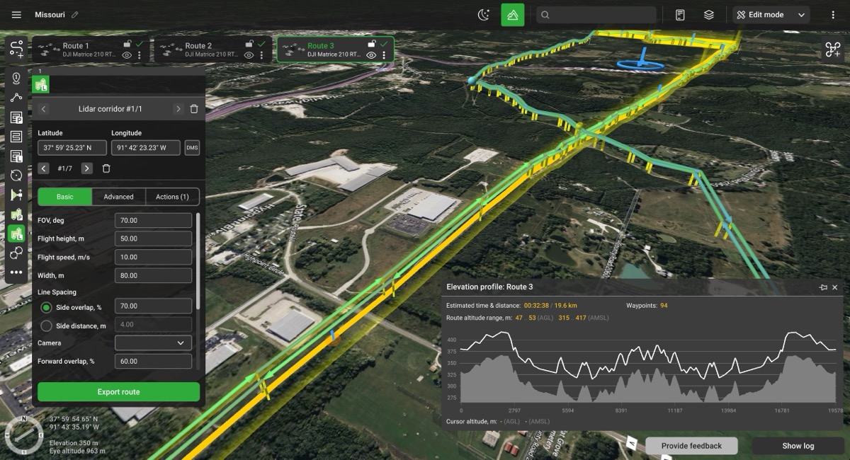
Key Features Used
- Terrain-following with public DEM integration
- Corridor Mapping Tool for structured, parallel flight lines
- Placemark tool to predefine launch zones and improve crew coordination
- GIS/KML import to match tower coordinates and utility asset layouts
- Offline planning for remote, no-signal zones
- Advanced gimbal and camera control for consistent image overlap
Results
With UgCS Enterprise in place, Trident can drop any new circuit into its GIS, press “Corridor,” and spin up a ready-to-fly mission in minutes. The result is a leaner inspection program that spends less time drawing dots on a map and more time keeping the lights on for Midwestern homes and businesses.
70% Reduction
in planning time per mission
30%-40% faster
field execution
Zero redundant flights
due to improved flight path accuracy
Higher quality
photogrammetry results with better overlap and AGL tracking
Consistent, repeatable workflows
across teams and drones
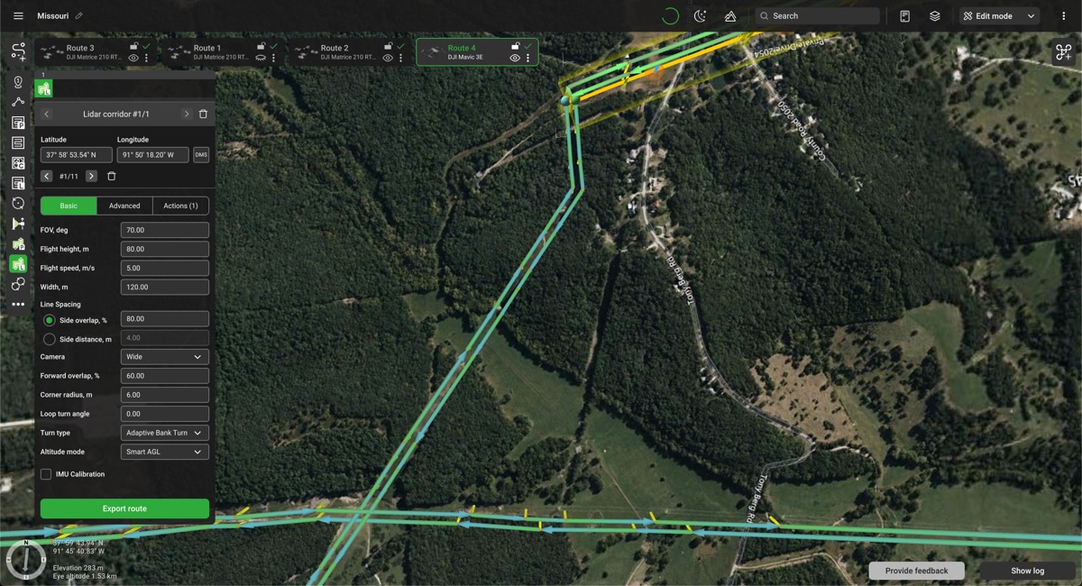
Competitive Advantage Gained
- Accurate terrain-adaptive flight paths
- GIS-driven mission planning
- Reliable pre-planning of launch sites with Placemarks
- Standardized ops across aircraft and operators
- Full offline capabilities in remote areas
Why Work With Trident Industries?
Trident Industries’ strategic interventions significantly contributed to the success of Ameren Transmission’s T-Line projects. By optimizing construction processes, fostering positive stakeholder relationships, and ensuring stringent quality control, Trident facilitated cost savings, minimized disruptions, and enhanced overall project performance. This case study underscores the importance of proactive project management and stakeholder engagement in achieving project success in the energy infrastructure sector.
Let us help you optimize your processes for a better project result!
Contact Us
Is a partnership with Trident Industries right for you? Contact us to learn more about how our expertise and quality services can help you facilitate lasting growth and progress.